Winnipeg’s Cozy and Artful Warming Huts

Woodpile HutWood Pile Hut

~

Skating on the frozen surface of the Assiniboine River, a popular winter pastime, will work up quite a chill.  Recognizing this, makeshift warming huts have long been used along the river to provide a temporary respite from the cold.  Several years ago (2010), a local art-and-architecture competition was started in Winnipeg to see how the simple warming hut might be creatively rethought.  The result has been an annual showcase of fun and function that does Winnipeg proud, as these images attest!  More about the warming huts can be found at the site for the annual competition.

~

The-Hole-idea

The Hole Idea Hut

~

Fir Hut

Fir Hut

~

Five-Hole-Hut----Gehry-Part

The Five-Hole Hut

~

Ha(y)ven Hut

Ha(y)ven Hut

~

Hygge House Hut

 The Hygge Hut

~

Ice Pillows Hut

Ice Pillows Hut

~

Red Blanket Hut

Red Blankets Hut

~

Rope Pavillion Hut

Rope Pavillion Hut

~

Windshield Hut

Windshield Hut

~

Image credits:   Warming Huts Competition Site

Breathtaking Kejimkujik Seaside

Seaweed and rocks, Kejimkujik National Seashore, NS

Seaweed and Rocks, Kejimkujik National Seaside, NS

___

On the south shore of Nova Scotia about 110 miles (175 km) southwest of Halifax sits the amazing Kejimkujik Seaside, which is an extension of the much larger inland Kejimkujik National Park.  Its remote hiking paths along windy shores offer breathtaking views of Nova Scotia at its natural best.  These pics are from a memorable hike there on an overcast day.

Windswept pine, Kejimkujik National Seashore, NS

Windswept Spruce, Kejimkujik National Seaside, NS

___

Color amidst the rocks, Kejimkujik National Seashore, NS

Color Amidst the Rocks, Kejimkujik National Seaside, NS

___

Rocks Among Tall Grass, Kejimkujik Seaside, NS

Rocks Among Tall Grass, Kejimkujik Seaside, NS

___

Wildflowers, Kejimkujik Seaside, NS

Wildflowers, Kejimkujik Seaside, NS

___

Lichen-Speckled Boulder, Kejimkujik Seaside, NS

Lichen-Speckled Boulder, Kejimkujik Seaside, NS

___

“Shapeshifter” Ben Marr Shreds the Mistassibi River

Like all the exceptional videos in the “Of Souls + Water” series, this eye-opener showing Ontario-based pro-kayaker Ben Marr’s playful mastery of Quebec’s Mistassibi River features dramatic narration, artistic filming and lighting (directed by Skip Armstrong), and an excellent soundtrack (this one: “With You” by Crystal Fighters).  On a side note, with all its hydro power, I knew Quebec has its share of massive rivers but until this video I was unaware just how big.  These waves rival some of the major whitewater swells that I’ve seen on West Virginia’s New River and stretches of the Colorado River coursing through the Grand Canyon.

Along the Ruggedly Beautiful Coast of Newfoundland

View From Signal Hill Near St. John's

View From Signal Hill Near St. John’s

I’ve been way up to the wonderful province of Newfoundland and Labrador twice and both times were amazing.  If you have the opportunity to visit this gorgeous rugged place populated with extremely hardy and friendly people, don’t hesitate –just go!  For myself, I look forward to my next trip there, exploring quaint outports and inhaling into my soul more if its innumerable beautiful vistas.  From my last trip, here are a few images that I took along the coast near St. John’s and about 200 miles further northeast on the Bonavista Peninsula around the picturesque villages of Trinity East and Port Rexton, both of which sit on Trinity Bay across from the Avalon Peninsula.

Harbor Scene Nfld

A Fishing Stage on a Quiet Cove

Nfld -- Boat on Grass

Boat Pulled Ashore, Port Rexton

Jerry Kobalenko’s Beautifully Rendered Arctic Eden

Arctic Eden

In light of the major blizzard that struck the northeastern U.S. yesterday and the deep freeze that settled over much of eastern Canada a couple of weeks ago,  I thought I’d continue with the winter theme of some of my recent posts (see Retro Winter Travel and Recreation Ads and “Ice Break” by Astrid Blodgett) by sharing my praise for Jerry Kobalenko’s Arctic Eden:  Journeys Through the Changing High Arctic.  Although it first caught my eye over a year ago and has been sitting on one of my shelves awaiting my attention since then, perhaps because this wintry season’s colder than usual weather had set the right mood,  I finally got around to reading it this past week.

Arctic Eden is part travelogue (or better put, adventurelogue), part historical overview of explorations of the High Arctic region of Canada, but mostly it is a beautiful  showcase of Kobalenko’s exquisite photography of the stark and at times haunting landscapes of the rugged northernmost latitudes of Canada.  Through the book Kobalenko, who is based in Alberta, narrates for his readers several sled-pulling treks through the extremities of Nunavut, including Devon Island, Axel Heiberg Island and Ellesmere Island, and he does it in such a way that one can readily visualize the experience of which he writes.

The text is nicely complemented by asides about early Arctic adventurers and local flora and fauna and the author’s stunning images that demonstrate his keen eye for the beauty of this harsh environment.   While shades of white and blue dominate the landscape, I was struck by the much wider range of vivid colors than I expected in these images of the Arctic.  What comes across most clearly is Kobalenko’s good-natured passion for outdoor adventure and his joyful appreciation for each visit to the High Arctic that he’s been privileged to make (apparently through much resourcefulness on his part).  I should also note that in several places he acknowledges his wife, Alexandra, as his steadfast companion in adventure and in preparing key parts of the book.  Undoubtedly, this thankful sensibility contributed to Arctic Eden’s receipt of the 2012 William Mills Prize for Non-Fiction with a polar theme.

I’ve posted above a handful of Kobalenko’s photos from the book, more of which can be viewed on his website (www.kobalenko.com).  His website, by the way, is quite nicely laid out and has information on ordering this and his other books as well as his photos.

Photo Credits:  Jerry Kobalenko

The Pride of the Mounties

Mountie On the Rapids

Ask most Americans about the Royal Canadian Mounted Police (RCMP) — more commonly called the Canadian Mounties — and you’ll frequently hear comments indicating a generally high regard for the Mounties and their association with the frontier derring do.  With their iconic red serge coats and dimpled Stetson hats, the public image of the Mounties has had a warm reception in the American imagination, even if over the years, like many police forces, they have had their ups and downs and share of controversies.

My early introduction to the Mounties included watching as a kid countless Dudley Do Right cartoons, which presented an amiable if bumbling caricature of a Mountie, and educational reels from school about the valor of the Mounties.  Slightly later came Monty Python’s humorous send up of another Canadian icon, the lumberjack, which featured the good-natured Mounties providing a back up chorus.  Probably because of all these sources I almost always thought of the Mounties as a wilderness fighting force, and did not fully understand their broader policing role.

The idea that the Mounties “always got their man” also stuck with me from childhood.  Fittingly, that unofficial motto was attributed to the Mounties by an American publication (at least according to the Wikipedia entry on the RCMP).  The RCMP as we know it today resulted from the merger of the Royal Northwest Mounted Police, which first patrolled the Northwest Territories starting in the late 1800s, and the country’s Dominion Police.   As testament to the acclaim enjoyed by the Mounties, they were frequent heroic subjects of popular American books, pulp fiction, magazine stories, radio shows and movies from the 1920s through the 1960s.  A sampling of related pop culture images is collected below.

Retro Winter Recreation and Travel Ads

Temperatures this far south, as well as the extreme cold gripping much of eastern Canada this week, leave no doubt that we’re deep in the heart of winter.  Because of this, my thoughts turn toward skiing, ice skating, hockey and other winter recreations and the many places above the 49th parallel — among them Banff, Quebec, Whistler, the Laurentians and Jasper — that are popular destinations for cold weather and snowy pastimes.  So, I thought I’d share some retro travel ads and posters touting these places and this season’s activities.  Many of these are from the Canadian Pacific Railway, which engaged in  a wide range of travel promotions for locations throughout Canada (and beyond).  The vivid graphics work their magic by conveying visions of boundless wintry pleasures.  Among the more distinctive of these works are those by Peter Ewart and Roger Couillard, two of the more notable artists commissioned for their attractive illustrations.  More Canadian Pacific travel posters may be seen here on an earlier O’Canada Blog post.

Image Credits:  Library and Archives Canada; Canadian Pacific Railway Archives

The Hidden Treasure That Is Haida Gwaii

“My interest in Haida Gwaii spiked when I mentioned it to a few more worldly adventure writers than myself — folks who spend their weekends traversing Mongolia on skis —  and got a collective “Haida what?” in response.  Can’t blame ’em.  Though it’s only 80 miles off  Canada’s Pacific coast, Haida Gwaii (previously known as the Queen Charlotte Islands) gets perpetually bypassed for the cruise-ship-frequented shores of nearby Alaska, just 50 miles to the north.  Getting to the island chain is also logistically challenging enough that the spoils remain a step removed.  . . . If you’re looking for a Lost World, these islands — isolated since the last Ice Age — fit the bill in every way that counts:  geographically, biologically, and culturally.”

Ted Alvarez, in “Canada: Treasure Island,” in Backpacker (Jan. 2013)

Haida Gwaii 2 Map

(Photo credits: Upyernoz per Wikimedia; Map credit: Koba-chan per Wikimedia)

The Great Fogo Island Punt Race 2011

Rowers in the 2010 Fogo Island Punt Race

Today marks the fifth annual running in Newfoundland of the Great Fogo Island Punt Race, a 10-mile endurance race that requires its challengers to row punts (essentially, small row boats) across five miles of open ocean between Fogo Island and Change Islands and back.  The official event website is here, which includes a couple of fascinating videos, including “Postcard From Fogo Island”, a gorgeous short video about the race which can also be found here on the website of the Shorefast Foundation.  Aside from being great fun, the annual race celebrates the boating heritage of Newfoundland and its reliance on the durable punt, a craft that the people throughout the province have relied upon for over 300 years.

The Long Studio on Fogo Island

I’ve commented on Fogo Island previously in a post on the National Film Board of Canada’s 1967 documentary “The Children of Fogo Island.”  In addition to its achingly beautiful scenery, this rugged island paradise in Atlantic Canada has a lot going for it, not the least of which is the resilient spirit of its people and their strong sense of community.   Fogo Island’s Shorefast Foundation has done a remarkable job in just a few short years in promoting both deliberate economic development and a phenomenally vibrant arts community.  Providing a good examplef this, is the above photo is of the Long Studio, one of three recently constructed and strikingly innovatively designed arts studios on the island as part of a series of broader arts initiatives fostered by the Fogo Island Arts Corporation and the Shorefast Foundation.

Like the Energizer Bunny, The Appalachian Trail Keeps Going and Going


Map of the SIA / IAT

I just got back from several days and about 65 miles of hiking with one of my sons on the Appalachian Trail in North Carolina.  Among the notable features along the North Carolina section of this major east coast footpath are many gorgeous vistas, beautiful water falls and streams and high mountain meadows.  The AT, as it is sometimes called, extends between Georgia up to Maine, following the range of the Appalachian Mountains over its 2,100+ miles in the U.S. 

As I was hiking, I recalled that the Appalachian range  actually ends much further north of Maine continuing as it does up into New Brunswick and Quebec on the mainland with a final section of the mountains ending near Belle Isle, Newfoundland and Labrador.   About 15 years ago, a number of hiking enthusiasts conceived what is called the “International Appalachian Trail”, which is a trail extension trail along the natural geography of this ancient mountain range into Canada without regard to national borders.  (Because North America, Europe and Africa were all once connected in truly ancient times, there is even an effort to route a trail with a continuation into Britain then onto Spain and finally in North Africa, linking together the geographical “remains” of this once vast inter-connected range.)   Already quite a few hikers have undertaken and completed the additional challenge associated with the trek from Mt. Katahdin, Maine up to Belle Isle. 

Endpoint of the Appalachian Trail in Maine

Having already hiked along several beautiful trails on Canada’s east coast, I’m sure the International AT holds special beauty and I’ll look forward to tackling stretches of it myself at some point.  For now, though, I’ll admire such feats from afar as my dogs are still barking from my most recent trail outing.

(Photo credit:  kworth30 / Wikimedia)

Nunavut: Doorway to the Arctic

Gull Glacier at Tanquary Fiord in Ukkusiksalik National Park

A few weeks ago Adventure Canada, the operators of an adventure tour in Nunavut, was forced to evacuate, with the assistance of the Canadian Coast Guard, over 100 passengers and dozens of crew members from its Clipper Adventurer because the ship struck a then-uncharted rock in Coronation Bay off the Arctic Ocean.  My heart went out to those whose amazing adventure into this vast wonderland had to be cut short.

The news reports of the incident focused my attention on Nunavut, which I have not visited (yet!).  From what I can tell, Nunavut is among the least visited Canadian provinces because of its remoteness.

Northeast Coast of Baffin Island

Although most of Nunavut is situated north of the Arctic Circle, because the province is so vast within its borders lies the geographic center of Canada.  The province is comprised of a massive expanse of mainland Canada and a sprawling archipelago, each with terrain as rugged as any to be found within the country.  Originally part of the Northwest Territories, Nunavut became a separate province in 1999 as part of a federal commitment to establish a territory for the indigenous Inuit people.

Pangnirtung Fiord at Auyuittiuq National Park

Link to Map of Nunavut: Map%20of%20Nunavut

(Photo credits:  Ansgar Walk, under Creative Commons License)


The Mighty Nahanni River


Albert Faille in his Longboat on the Nahanni River

I spent several days last week with my youngest son hiking and camping along a 30-mile stretch of the Appalachian Trail, or the AT, as it is commonly called, in Georgia.  Most of the AT in Georgia is full of steep ascents and descents, so each mile takes its toll and leaves a big impression.  Hiking also lends itself to quiet reflection, which alone is sufficient reason to endure the inevitable aches and pains.

So it was that during one extended ascent along our route that I found myself thinking back to a video I had seen some months ago about the arduous life of an itinerant gold prospector named Albert Faille, who lived along the Nahanni River in the Northwest Territories.  The video documented Faille’s eighth unsuccessful attempt in as many years to navigate 400 miles up the magnificent Nahanni River to access a legendary gold mine.   What stood out for me was the tenacity of this fellow.  Among other things, he had to portage around the torrential Virginia Falls — falls that are twice as high as Niagara.  You could feel his effort as he carried the considerable contents of his longboat up a steep hillside and around the falls, which required trip after trip until it was all safely stowed.  He even brought with him extra lumber to build by hand another boat at the top of the falls, which took him about a week to do.  Unfortunately, between the delays in getting up river and the challenges posed by the river itself, Faille was forced to retreat 40 or so miles short of his goal.  Nevertheless, his dauntlessness served as a source of inspiration to me on my own arduous, albeit much milder, trek up a ridge or two of the Appalachians.

A link to the fairly short video (approx. 18 minutes) on the website of the National Film Board of Canada is here:  http://www.nfb.ca/film/Nahanni/.  The video, which is characterized by overly wrought  music and a melodramatic narrator, both typical of the 1960s documentary style, does a nice job highlighting the unmistakable beauty of the region.  I suspect this is an area that not only is not well-traveled due to its remoteness, but is likely also not even very well-known.  Yet, as a testament to its magnificence, Nahanni National Park was the first place designated as a World Heritage Site by the U.N.  I have not had the privilege yet of actually visiting Nahanni National Park but I hope to at some point.

Visit to Cape Breton Island

(Looking south along the Cabot Trail)

(River near Capstick, flowing out to the North Atlantic)

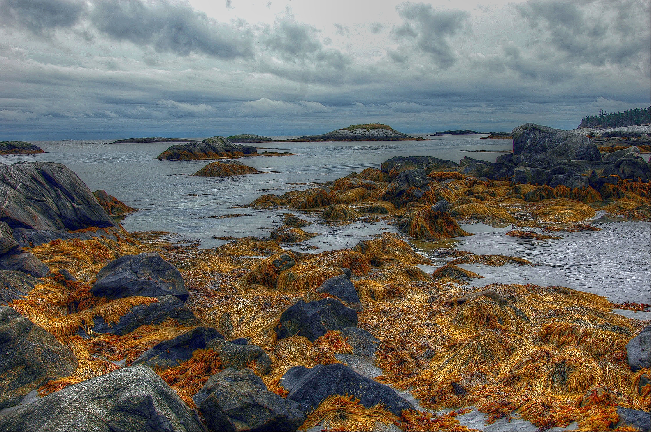
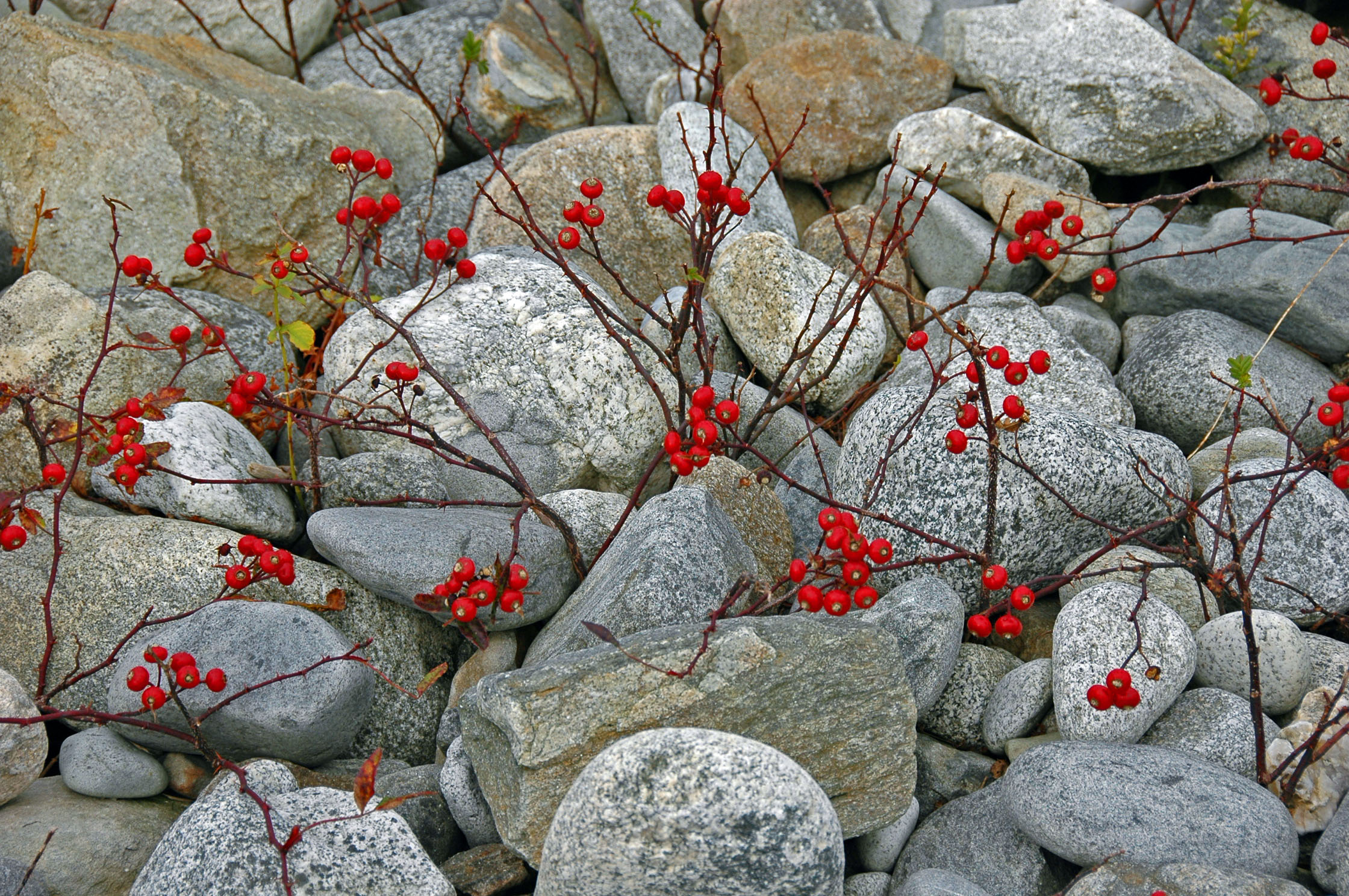
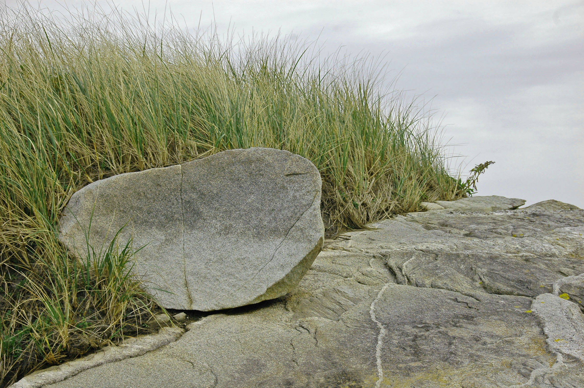
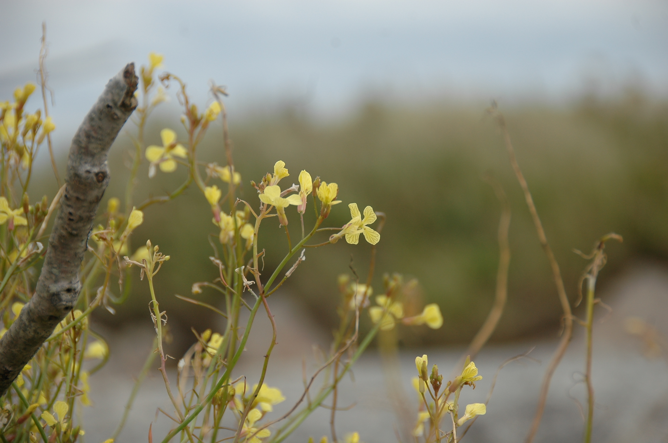
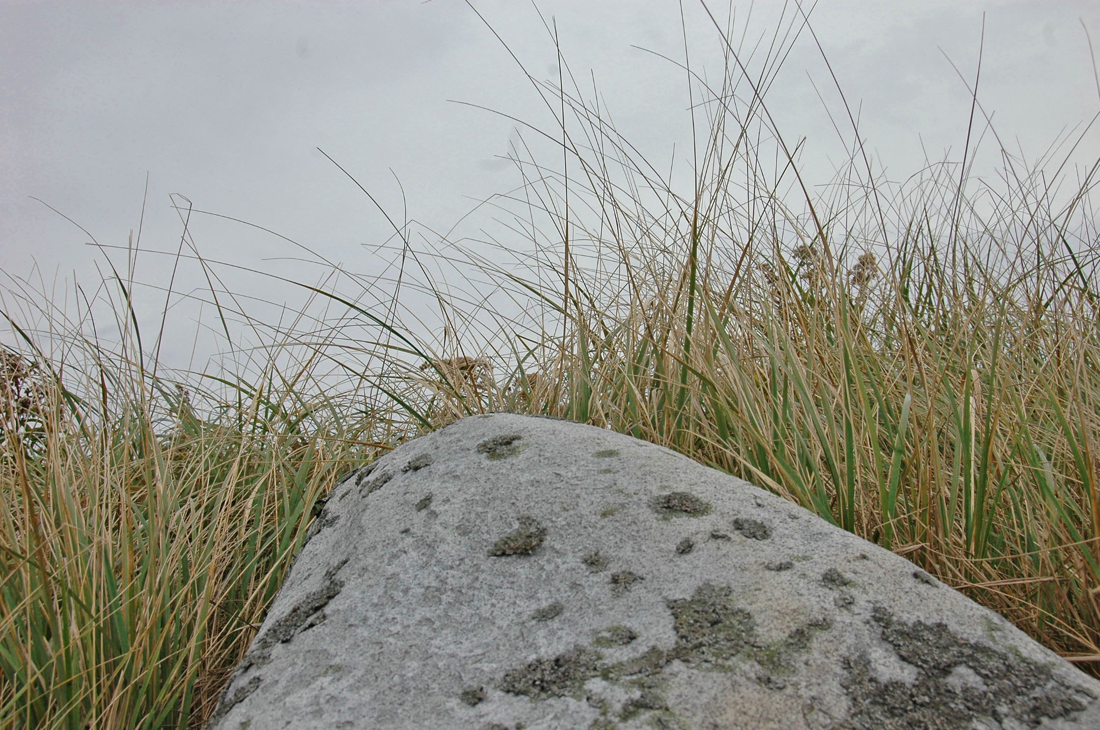
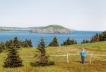
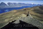
This past October, as a birthday trip for my wife, she and I visited Cape Breton Island, Nova Scotia, a place where there remains many strong connections to this province’s Acadian and Scottish heritage.  It turned out to be a perfect time of the year to take in the stunning golds, crimsons and oranges of the fall foliage.  The coastal scenery from the winding Cabot Trail roadway, which skirts much of the perimeter of Cape Breton, is rugged,  dramatic and gorgeously beautiful.  The jewel in the middle of the route is Cape Breton-Highlands National Park, a massive park which was the first designated Canadian National Park in the Atlantic Provinces.  Several strenuous to easy hiking trails accommodate different levels of hiker.  We spent several hours along the Skyline Trail, a moderate hike, from one end of which you can gaze across endless vistas of the surrounding ocean while also watching whales continually breach the water far below as eagles soar overhead and, if you’re lucky (we were!), get a glimpse of one or more moose in the surrounding bog.  For an amateur photographer such as myself there are opportunities for wonderful images in just about every direction and along every mile.  Posted below (and above) are some of my favorites from that trip.

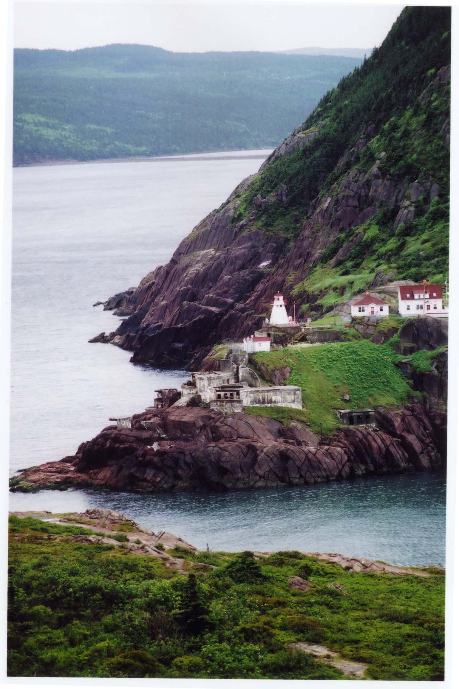
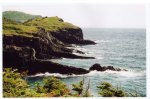
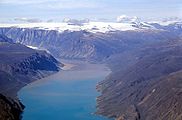
Capstick, a tiny community on the northwestern tip of Cape Breton, just north of the Cabot Trail.  After meandering late in the afternoon to see what was around “just one more bend in the road” we came across this amazing vista:

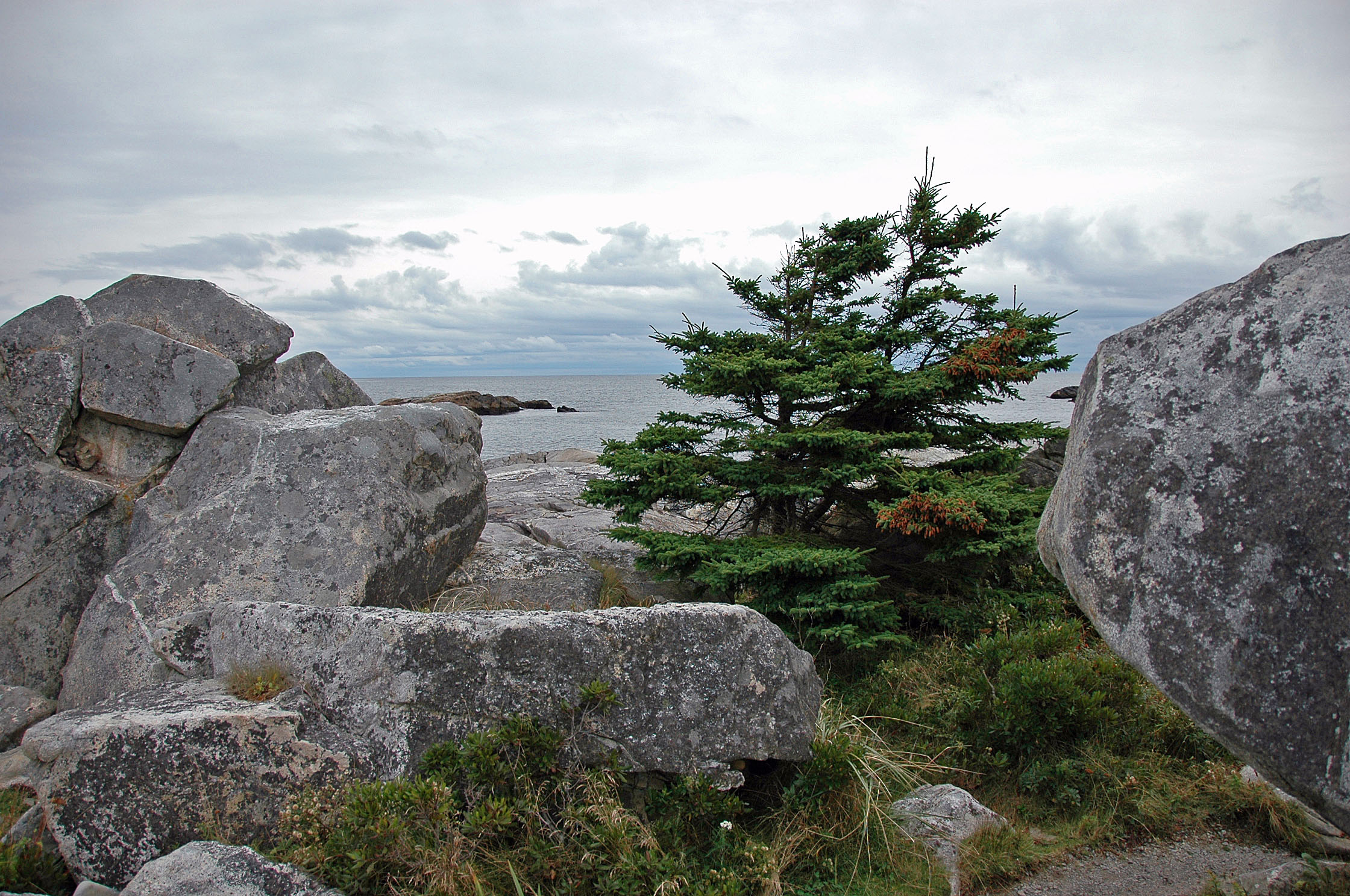
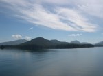
Another view of Capstick:

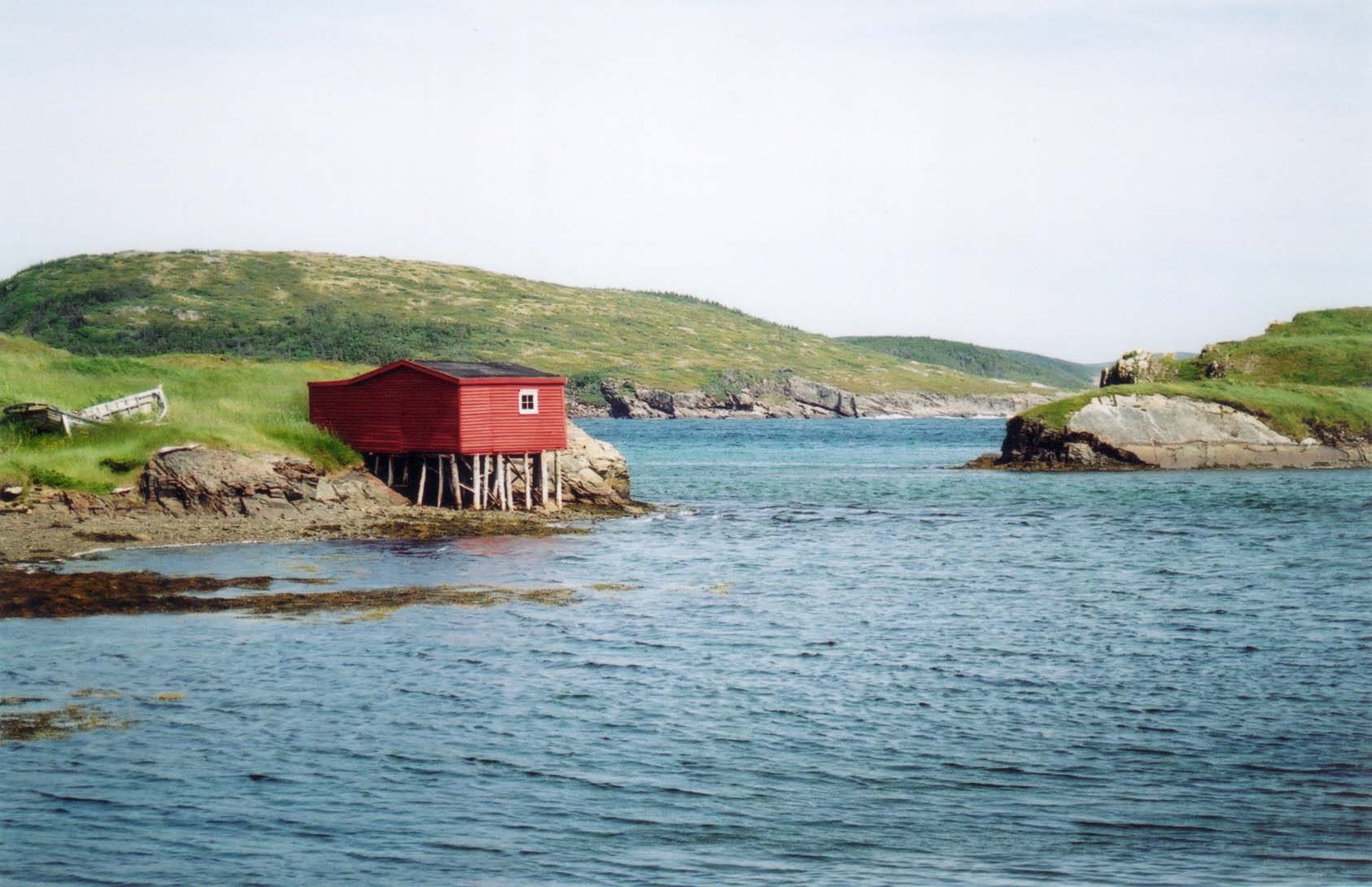
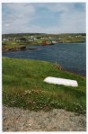
Around Neils Harbor, a charming fishing village.  It was raining this day and I had to snap quickly, so shot is not as sharp as I’d like:

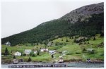
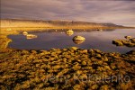
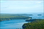
Bras d’Or Lake, near Baddeck — a larger town set against picture-perfect lake scenery:
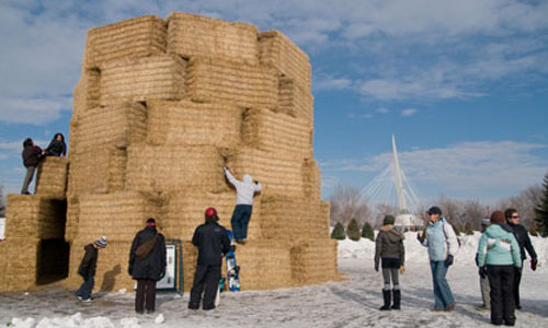
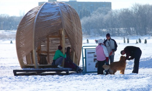
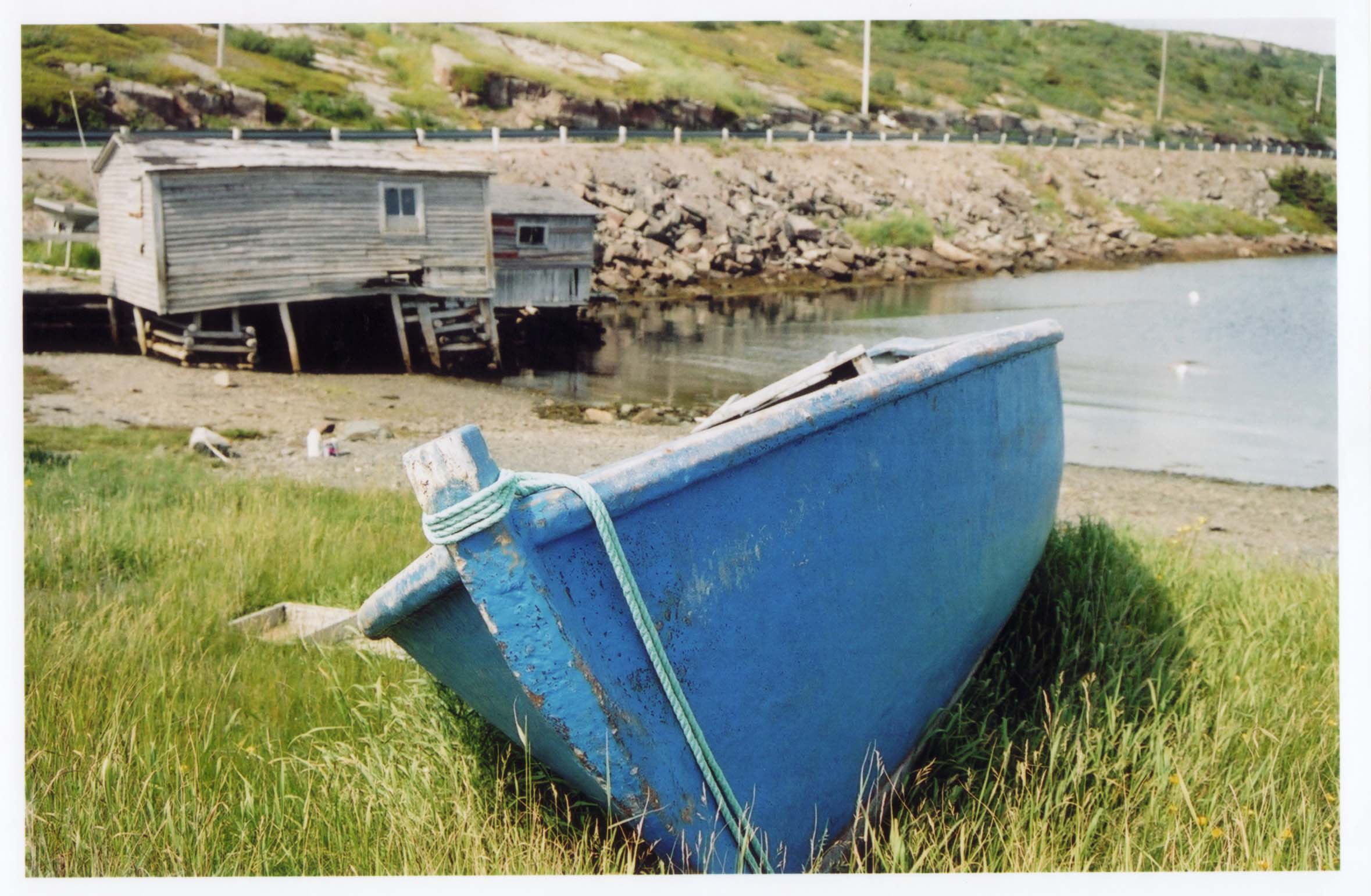
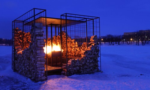
 

%d bloggers like this: