James Fowler’s Wonderful Geometric Cityscapes

James Fowler “The Village, Toronto” (2017)

~

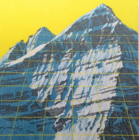
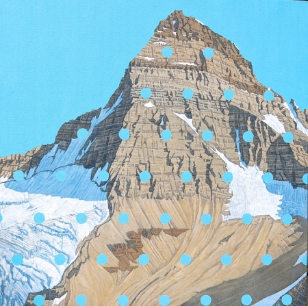
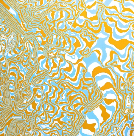
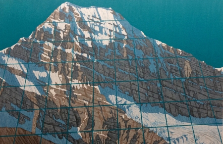
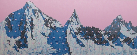
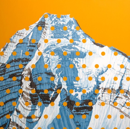
James Fowler’s non-traditional landscape paintings perfectly merge broad aerial-like vistas with a strong geometric and digital sensibility.  His artwork hints at the methods of the nineteenth century pointillists and, of more contemporary vintage, Chuck Close’s “pixellated” portrait paintings.    The result in Fowler’s talented hands and imagination is a distinctive abstract style of landscape that is slightly whimsical and very impressive.

As this Toronto-based artist notes on his websites’s artist statement, the idea, partly, is to convey the “lively feelings one gets when flying into a new big city for the first time, when we try to take everything in, or the lasting impressions stored in our memories of traveling anywhere far from home.”  Well said!  And he’s done this with cities throughout Canada, the United States and across the world, as indicated by the small sampling noted here.

More of Fowler’s vibrant work can be seen on his website here and on his Twitter feed here.

James Fowler, “8Bit Montreal” (2017)

~

James Fowler, “San Francisco” (2016)

~

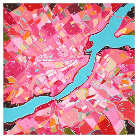
James Fowler, “Quebec City” (2019)

~

James Fowler, “Fredericton” (2018)

~

James Fowler, “Downtown, Kansas City” (2019)


(Image Credits: James Fowler)


Similar Posts on O’Canada:

Artist to Appreciate: Katharine Burns

Elyse Dodge’s Imaginative Geometric Landscapes

Artist to Appreciate: Miyoshi Kondo


Vintage Picture Map Geography of Canada

nw-territories

I recently came across a copy of an old school book, “Picture Map Geography of Canada and Alaska” by Vernon Quinn, that includes charming woodcut picture maps by Bruno da Osimo, a then noted Italian illustrator, for each of the Canadian provinces (other than Nunavut, which was then part of the Northwest Territories).  Originally published in 1944 and updated in 1954, it has a light but well-written chapter devoted to individual provinces.  Each map features animals, plants, activities and industries peculiar to the province depicted.  In addition to the maps (scanned in above and below), the book is adorned throughout with other delightful illustrations by da Osima (some of which I’ll compile in a future post).

alberta british-columbia manitoba-saskatchewan newfoundland nova-scotia-new-brunswick-pei ontario-2 quebec yukon


Similar Posts on O’Canada Blog:

1933 Quebec Tourist Road Map

Old Maps and Their Hidden Stories

Songs & Ballads From Nova Scotia

David Pirrie: Mapping Western Terrains and Our Sense of Place

David Pirrie, Mt Phillips, BC Rockies (2016)

David Pirrie, Mt. Phillips, BC Rockies (2016)

There’s a great deal of pleasure to be found studying maps, replete as they are with seemingly arcane symbols, dots, lines and grids awaiting patient deciphering.   Among the fascinations of Vancouver-based artist David Pirrie is the iconography of maps and how they influence our sense of place, which he nicely explores in a wonderful series of paintings recently exhibited at Vancouver’s Ian Tan Gallery.

Pirrie’s paintings of Canada’s western landscape, particularly of mountains in the Alberta  and British Columbia Rockies, are overlayed with mapping details and pastel hues that display a slight pop art sensibility that is both intriguing and pleasing.  His having climbed many of these mountains adds an element of intimacy to his gorgeous representations of these majestic formations.

More of David Pirrie’s work can be seen at his website here.

David Pirrie, Mt Assiniboine, Late Summer (2016)

David Pirrie, Mt. Assiniboine, Late Summer(2016)

~

David Pirrie, Columbia Icefield (2016)

David Pirrie, Columbia Icefield , 1/50,000 (2016)

~

David Pirrie, Mt Edith Cavell (2016)

David Pirrie, Mt. Edith Cavell (2016)

~

David Pirrie, Kates Needle, BC Coast (2013)

David Pirrie, Kates Needle, BC Coast (2013)

~

David Pirrie, Mt Robson Ice Fall (2016)

 David Pirrie, Mt. Robson Ice Fall (2016)

~

Old Maps and Their Hidden Stories

Nova Canadae 1693

Nova Canadae (1693)

*

Good historical maps combine science and art to guide its users through its subject geography, with the best such maps igniting the imagination about the many backstories underpinning its cartographical offerings. Some of the oldest maps of North America include parts of Canada, which then featured place names such Terra Nova (now Newfoundland), Nouvelle France (most of what is now Eastern Canada), and Acadie (now Nova Scotia).  The following collection showcases some interesting old maps of Canada I’ve come across.

Related Posts on O’Canada:

1933 Quebec Tourist Road Map

1933 Quebec Tourist Road Map

1933 Quebec Map Cover

I’ve always appreciated the intricacies that permeate just about any map, each being a kind of artwork exhibiting both  numerous rules of expression and many quirky curiosities.  A few months ago, in preparation for a creative project I planned to undertake,  I assembled a collection of about 200 vintage road maps, many from the period 1930-1960.   Among the many gems in this passel was an official Canada Roads Department map of Quebec from 1933, a time when travel by car was still fairly new and roads were not nearly as well developed as today.  As evident from the lack of roads across much of the map, vast expanses of this wonderful province were virtually inaccessible by any vehicle.

Quebec City Area

Times were obviously simpler then.  Helpful pointers on the map included the admonition that speed limits within Quebec for touring cars were 20 m.p.h. within any city or town limits and 30 m.p.h. in open country — now we’re flying!  For commercial vehicles, things were truly at a crawl, with a loaded truck with inflatable tires being limited to no more than a leisurely 12 m.p.h.  Roads being less well paved than they are are today, mud splashing was also a particular concern as the tips for motorists warned that for this “you are liable for damages.”

Quebec Map Speed Limit Detail_0002___

Quebec Map Tips